


clos la cime

mthomas30
User
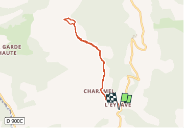

Length
7.2 km

Max alt
1582 m

Uphill gradient
394 m
Km-Effort
12.4 km

Min alt
1195 m

Downhill gradient
394 m
Boucle
Yes
Creation date :
2024-08-07 16:06:32.939
Updated on :
2024-08-07 17:34:10.397
1h21
Difficulty : Very easy

FREE GPS app for hiking
 SityTrail
IGN / Geographical institutes
SityTrail Plus
The world is yours!
About
Trail Running of 7.2 km to be discovered at Provence-Alpes-Côte d'Azur, Alpes-de-Haute-Provence, Ubaye-Serre-Ponçon. This trail is proposed by mthomas30.
Positioning
Country:
France
Region :
Provence-Alpes-Côte d'Azur
Department/Province :
Alpes-de-Haute-Provence
Municipality :
Ubaye-Serre-Ponçon
Location:
La Bréole
Start:(Dec)
Start:(UTM)
284747 ; 4922506 (32T) N.
Comments