


ddf

lurando
User
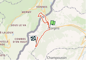

Length
11.1 km

Max alt
1659 m

Uphill gradient
564 m
Km-Effort
18.1 km

Min alt
1336 m

Downhill gradient
420 m
Boucle
No
Creation date :
2024-08-08 07:09:39.163
Updated on :
2024-08-08 11:35:51.941
4h25
Difficulty : Difficult

FREE GPS app for hiking
 SityTrail
IGN / Geographical institutes
SityTrail Plus
The world is yours!
About
Trail Walking of 11.1 km to be discovered at Valais/Wallis, Monthey, Troistorrents. This trail is proposed by lurando.
Positioning
Country:
Switzerland
Region :
Valais/Wallis
Department/Province :
Monthey
Municipality :
Troistorrents
Location:
Unknown
Start:(Dec)
Start:(UTM)
334398 ; 5122693 (32T) N.
Comments