


rando hilsen chalet ami nature Wittenheim

JWeiszrock
User
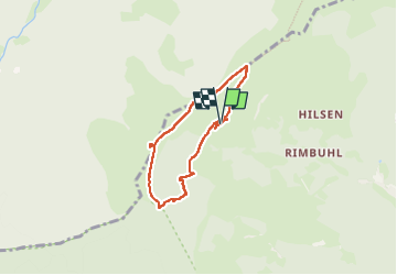

Length
5.3 km

Max alt
1267 m

Uphill gradient
206 m
Km-Effort
8 km

Min alt
1065 m

Downhill gradient
198 m
Boucle
Yes
Creation date :
2024-08-11 08:08:11.364
Updated on :
2024-08-11 09:47:35.607
1h25
Difficulty : Medium

FREE GPS app for hiking
 SityTrail
IGN / Geographical institutes
SityTrail Plus
The world is yours!
About
Trail Walking of 5.3 km to be discovered at Grand Est, Haut-Rhin, Linthal. This trail is proposed by JWeiszrock.
Positioning
Country:
France
Region :
Grand Est
Department/Province :
Haut-Rhin
Municipality :
Linthal
Location:
Unknown
Start:(Dec)
Start:(UTM)
357704 ; 5313986 (32T) N.
Comments