


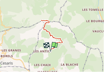
Le Piolit par le col de Chorges

cron
User

Length
13.7 km

Max alt
2434 m

Uphill gradient
1040 m
Km-Effort
28 km

Min alt
1455 m

Downhill gradient
1041 m
Boucle
Yes
Creation date :
2024-08-15 19:34:20.241
Updated on :
2024-08-15 19:34:55.565
6h15
Difficulty : Difficult

FREE GPS app for hiking
 SityTrail
IGN / Geographical institutes
SityTrail Plus
The world is yours!
About
Trail Walking of 13.7 km to be discovered at Provence-Alpes-Côte d'Azur, Hautes-Alpes, Chorges. This trail is proposed by cron.
Positioning
Country:
France
Region :
Provence-Alpes-Côte d'Azur
Department/Province :
Hautes-Alpes
Municipality :
Chorges
Location:
Unknown
Start:(Dec)
Start:(UTM)
283914 ; 4939547 (32T) N.
Comments