


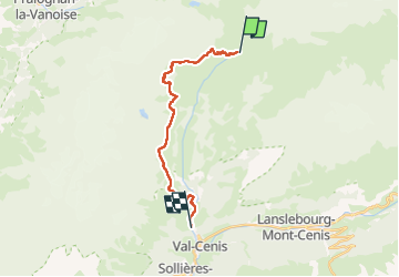
Val Cenis par navette Doron rive droite

c.gourme
User

Length
18.1 km

Max alt
2580 m

Uphill gradient
701 m
Km-Effort
30 km

Min alt
1316 m

Downhill gradient
1430 m
Boucle
No
Creation date :
2024-08-19 06:50:12.0
Updated on :
2024-08-23 13:14:02.588
6h47
Difficulty : Difficult

FREE GPS app for hiking
 SityTrail
IGN / Geographical institutes
SityTrail Plus
The world is yours!
About
Trail Walking of 18.1 km to be discovered at Auvergne-Rhône-Alpes, Savoy, Val-Cenis. This trail is proposed by c.gourme.
Description
Prendre la navette à Termignon beau parcours en balcon
Positioning
Country:
France
Region :
Auvergne-Rhône-Alpes
Department/Province :
Savoy
Municipality :
Val-Cenis
Location:
Termignon
Start:(Dec)
Start:(UTM)
330940 ; 5025332 (32T) N.
Comments