


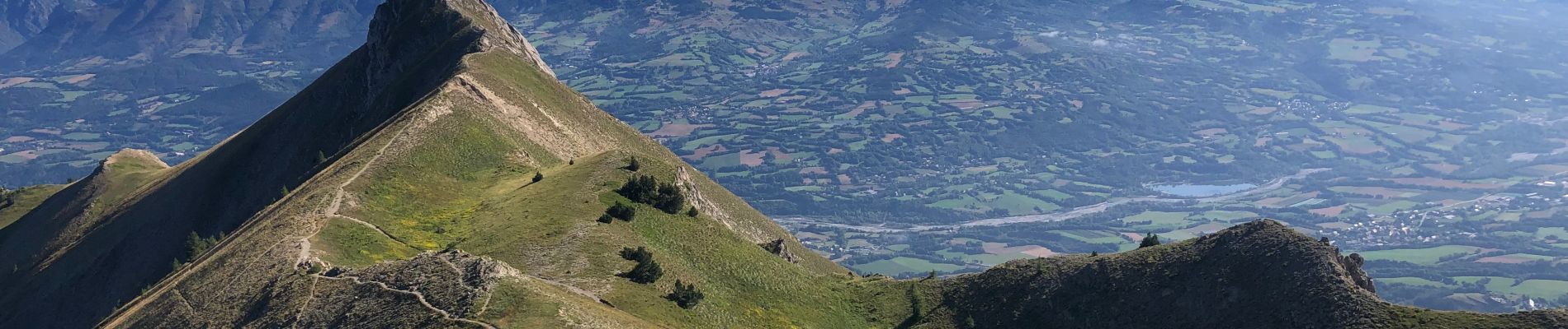
Le pic de Gleize

Fabichette
User
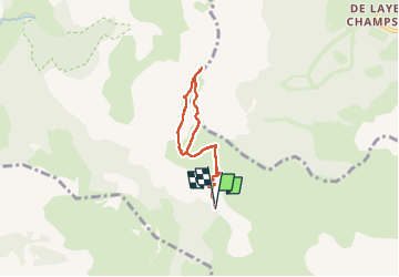

Length
5.8 km

Max alt
2142 m

Uphill gradient
446 m
Km-Effort
11.8 km

Min alt
1697 m

Downhill gradient
454 m
Boucle
Yes
Creation date :
2024-08-20 06:23:23.0
Updated on :
2024-08-20 09:50:43.948
2h02
Difficulty : Medium

FREE GPS app for hiking
 SityTrail
IGN / Geographical institutes
SityTrail Plus
The world is yours!
About
Trail Walking of 5.8 km to be discovered at Provence-Alpes-Côte d'Azur, Hautes-Alpes, Gap. This trail is proposed by Fabichette.
Description
Magnifique randonnée avec des vues incroyables sur la massif des Écrins par beau temps bien sûr. Ça grimpe mais l’effort en vaut largement la peine !
Photos


Positioning
Country:
France
Region :
Provence-Alpes-Côte d'Azur
Department/Province :
Hautes-Alpes
Municipality :
Gap
Location:
Gap
Start:(Dec)
Start:(UTM)
265819 ; 4945161 (32T) N.
Comments