


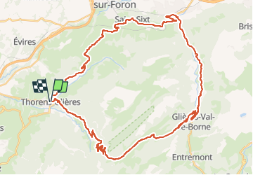
THORENS PLATEAU LES GLIERES ET RETOUR COL DES FLEURIES

leclaude74
User

Length
50 km

Max alt
1449 m

Uphill gradient
1492 m
Km-Effort
70 km

Min alt
494 m

Downhill gradient
1490 m
Boucle
Yes
Creation date :
2024-08-20 06:54:54.587
Updated on :
2024-08-20 18:14:29.656
3h15
Difficulty : Difficult

FREE GPS app for hiking
 SityTrail
IGN / Geographical institutes
SityTrail Plus
The world is yours!
About
Trail Road bike of 50 km to be discovered at Auvergne-Rhône-Alpes, Upper Savoy, Fillière. This trail is proposed by leclaude74.
Description
Liaison sommet plateau des Glières pas goudronnée mais avec un chemin carrossable même avec un vélo de route .
Descente côté petit Bornand bien engagée .
Positioning
Country:
France
Region :
Auvergne-Rhône-Alpes
Department/Province :
Upper Savoy
Municipality :
Fillière
Location:
Unknown
Start:(Dec)
Start:(UTM)
287041 ; 5097331 (32T) N.
Comments