


wesserling au Treh et retour

jcguew
User
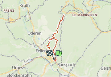

Length
11.6 km

Max alt
1129 m

Uphill gradient
699 m
Km-Effort
21 km

Min alt
438 m

Downhill gradient
699 m
Boucle
Yes
Creation date :
2024-08-22 07:14:24.348
Updated on :
2024-08-22 14:41:24.534
4h47
Difficulty : Very difficult

FREE GPS app for hiking
 SityTrail
IGN / Geographical institutes
SityTrail Plus
The world is yours!
About
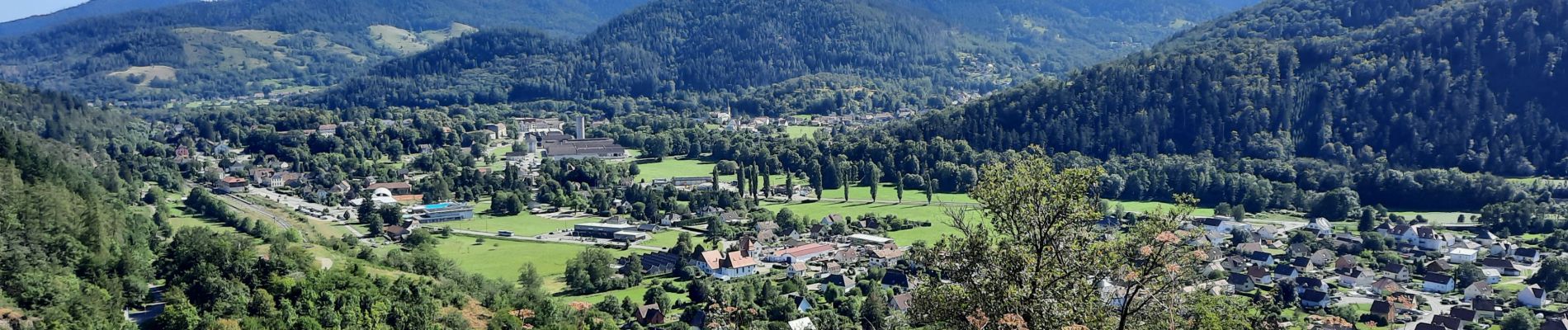
Trail Walking of 11.6 km to be discovered at Grand Est, Haut-Rhin, Fellering. This trail is proposed by jcguew.
Photos


Positioning
Country:
France
Region :
Grand Est
Department/Province :
Haut-Rhin
Municipality :
Fellering
Location:
Unknown
Start:(Dec)
Start:(UTM)
350339 ; 5305954 (32T) N.
Comments