


Montgenèvre Sommet des Anges 240825

Specialized77
User GUIDE
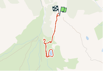

Length
3.6 km

Max alt
2197 m

Uphill gradient
130 m
Km-Effort
5.3 km

Min alt
2106 m

Downhill gradient
135 m
Boucle
Yes
Creation date :
2024-08-25 12:08:09.791
Updated on :
2024-09-06 16:25:05.388
1h12
Difficulty : Easy

FREE GPS app for hiking
 SityTrail
IGN / Geographical institutes
SityTrail Plus
The world is yours!
About
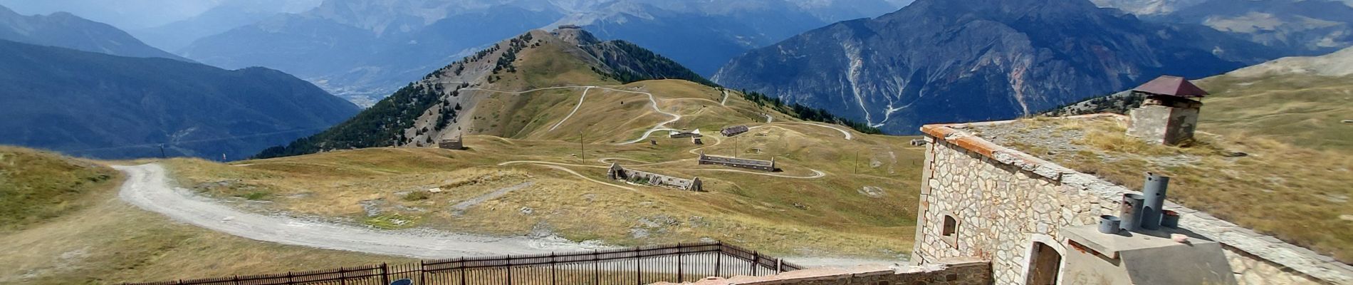
Trail Walking of 3.6 km to be discovered at Provence-Alpes-Côte d'Azur, Hautes-Alpes, Montgenèvre. This trail is proposed by Specialized77.
Photos


Positioning
Country:
France
Region :
Provence-Alpes-Côte d'Azur
Department/Province :
Hautes-Alpes
Municipality :
Montgenèvre
Location:
Unknown
Start:(Dec)
Start:(UTM)
320768 ; 4976015 (32T) N.
Comments