


Fermette

jcschubnel
User
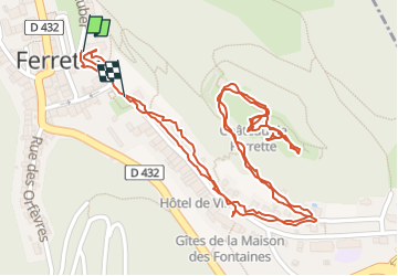

Length
2.1 km

Max alt
595 m

Uphill gradient
91 m
Km-Effort
3.3 km

Min alt
500 m

Downhill gradient
77 m
Boucle
Yes
Creation date :
2024-07-14 10:43:10.386
Updated on :
2024-08-31 14:24:22.631
51m
Difficulty : Easy

FREE GPS app for hiking
 SityTrail
IGN / Geographical institutes
SityTrail Plus
The world is yours!
About
Trail Walking of 2.1 km to be discovered at Grand Est, Haut-Rhin, Ferrette. This trail is proposed by jcschubnel.
Positioning
Country:
France
Region :
Grand Est
Department/Province :
Haut-Rhin
Municipality :
Ferrette
Location:
Unknown
Start:(Dec)
Start:(UTM)
373058 ; 5261502 (32T) N.
Comments