


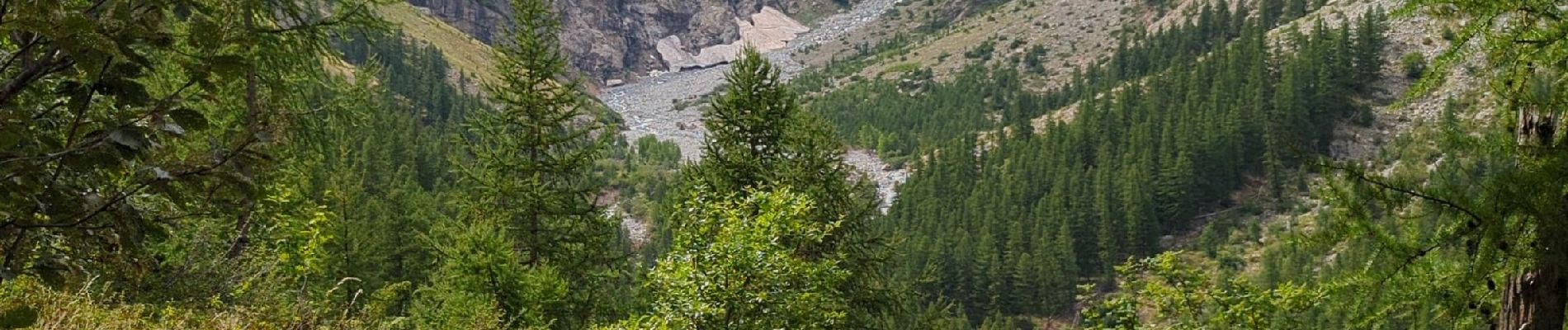
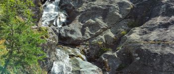
Cascade de Clapouse

patsure
User

Length
7 km

Max alt
1925 m

Uphill gradient
426 m
Km-Effort
12.7 km

Min alt
1504 m

Downhill gradient
428 m
Boucle
Yes
Creation date :
2024-08-30 11:54:49.728
Updated on :
2024-08-31 18:47:48.041
2h31
Difficulty : Medium

FREE GPS app for hiking
 SityTrail
IGN / Geographical institutes
SityTrail Plus
The world is yours!
About
Trail Walking of 7 km to be discovered at Provence-Alpes-Côte d'Azur, Hautes-Alpes, Vallouise-Pelvoux. This trail is proposed by patsure.
Description
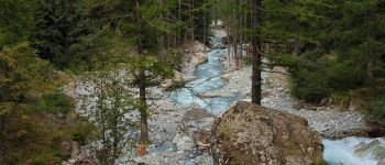
attention prendre la 1ere passerelle
la suivante a été detruite
Photos


Positioning
Country:
France
Region :
Provence-Alpes-Côte d'Azur
Department/Province :
Hautes-Alpes
Municipality :
Vallouise-Pelvoux
Location:
Pelvoux
Start:(Dec)
Start:(UTM)
298288 ; 4973678 (32T) N.
Comments