


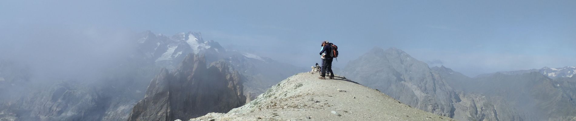
pointe des Cerces

orsel
User GUIDE
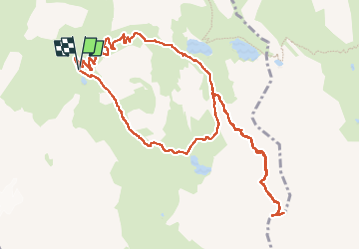

Length
13.2 km

Max alt
3071 m

Uphill gradient
973 m
Km-Effort
26 km

Min alt
2140 m

Downhill gradient
968 m
Boucle
Yes
Creation date :
2024-09-06 06:15:44.14
Updated on :
2024-09-06 18:11:00.71
6h52
Difficulty : Difficult

FREE GPS app for hiking
 SityTrail
IGN / Geographical institutes
SityTrail Plus
The world is yours!
About
Trail Walking of 13.2 km to be discovered at Auvergne-Rhône-Alpes, Savoy, Valloire. This trail is proposed by orsel.
Photos


Positioning
Country:
France
Region :
Auvergne-Rhône-Alpes
Department/Province :
Savoy
Municipality :
Valloire
Location:
Unknown
Start:(Dec)
Start:(UTM)
299593 ; 4995337 (32T) N.
Comments