


Lac des Échines

Chabard
User

Length
17.7 km

Max alt
2377 m

Uphill gradient
850 m
Km-Effort
29 km

Min alt
1571 m

Downhill gradient
871 m
Boucle
No
Creation date :
2024-09-10 07:22:44.0
Updated on :
2024-09-15 17:48:44.92
7h56
Difficulty : Medium

FREE GPS app for hiking
 SityTrail
IGN / Geographical institutes
SityTrail Plus
The world is yours!
About
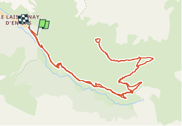
Trail Walking of 17.7 km to be discovered at Auvergne-Rhône-Alpes, Savoy, Champagny-en-Vanoise. This trail is proposed by Chabard.
Description
Lac des Échines au départ du Laisonnay
Positioning
Country:
France
Region :
Auvergne-Rhône-Alpes
Department/Province :
Savoy
Municipality :
Champagny-en-Vanoise
Location:
Unknown
Start:(Dec)
Start:(UTM)
326707 ; 5034902 (32T) N.
Comments