


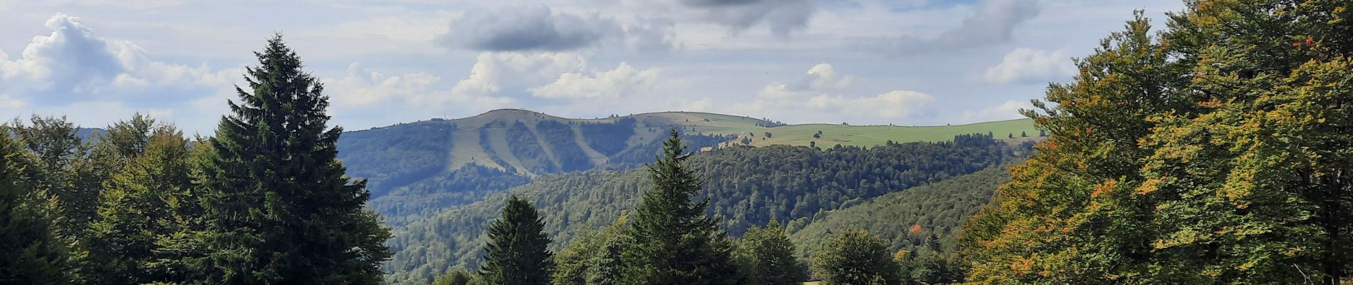
Markstein/Treh, Breitfist, Oberlauchen, Markstein

jcguew
User
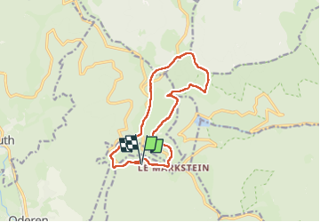

Length
12.8 km

Max alt
1276 m

Uphill gradient
336 m
Km-Effort
17.3 km

Min alt
1104 m

Downhill gradient
334 m
Boucle
Yes
Creation date :
2024-09-22 07:49:15.702
Updated on :
2024-09-22 13:26:59.476
4h29
Difficulty : Difficult

FREE GPS app for hiking
 SityTrail
IGN / Geographical institutes
SityTrail Plus
The world is yours!
About
Trail Walking of 12.8 km to be discovered at Grand Est, Haut-Rhin, Ranspach. This trail is proposed by jcguew.
Photos


Positioning
Country:
France
Region :
Grand Est
Department/Province :
Haut-Rhin
Municipality :
Ranspach
Location:
Unknown
Start:(Dec)
Start:(UTM)
352066 ; 5309773 (32T) N.
Comments