


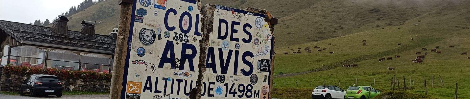
col avaris

apa
User
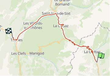

Length
29 km

Max alt
1489 m

Uphill gradient
585 m
Km-Effort
38 km

Min alt
617 m

Downhill gradient
963 m
Boucle
No
Creation date :
2024-09-27 08:26:39.768
Updated on :
2024-09-27 14:02:17.198
1h55
Difficulty : Difficult

FREE GPS app for hiking
 SityTrail
IGN / Geographical institutes
SityTrail Plus
The world is yours!
About
Trail Road bike of 29 km to be discovered at Auvergne-Rhône-Alpes, Savoy, Flumet. This trail is proposed by apa.
Description
panoramique
Photos

Positioning
Country:
France
Region :
Auvergne-Rhône-Alpes
Department/Province :
Savoy
Municipality :
Flumet
Location:
Unknown
Start:(Dec)
Start:(UTM)
306284 ; 5080055 (32T) N.
Comments