


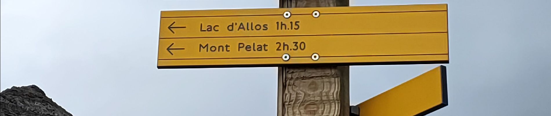
Lac d'Allos petite cayolle

kephas
User
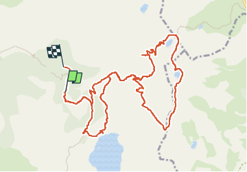

Length
14.8 km

Max alt
2675 m

Uphill gradient
642 m
Km-Effort
23 km

Min alt
2079 m

Downhill gradient
670 m
Boucle
No
Creation date :
2024-09-27 08:28:05.831
Updated on :
2024-09-27 16:42:05.787
6h13
Difficulty : Difficult

FREE GPS app for hiking
 SityTrail
IGN / Geographical institutes
SityTrail Plus
The world is yours!
About
Trail Walking of 14.8 km to be discovered at Provence-Alpes-Côte d'Azur, Alpes-de-Haute-Provence, Allos. This trail is proposed by kephas.
Photos


Positioning
Country:
France
Region :
Provence-Alpes-Côte d'Azur
Department/Province :
Alpes-de-Haute-Provence
Municipality :
Allos
Location:
Unknown
Start:(Dec)
Start:(UTM)
316169 ; 4901666 (32T) N.
Comments