


Abbaye de Tamié

apa
User
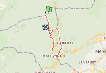

Length
5.9 km

Max alt
950 m

Uphill gradient
161 m
Km-Effort
8.1 km

Min alt
841 m

Downhill gradient
182 m
Boucle
No
Creation date :
2024-09-28 09:02:30.13
Updated on :
2024-09-28 11:15:13.978
2h12
Difficulty : Easy

FREE GPS app for hiking
 SityTrail
IGN / Geographical institutes
SityTrail Plus
The world is yours!
About
Trail Walking of 5.9 km to be discovered at Auvergne-Rhône-Alpes, Savoy, Plancherine. This trail is proposed by apa.
Description
panoramique
Photos


Positioning
Country:
France
Region :
Auvergne-Rhône-Alpes
Department/Province :
Savoy
Municipality :
Plancherine
Location:
Unknown
Start:(Dec)
Start:(UTM)
289916 ; 5063129 (32T) N.
Comments