


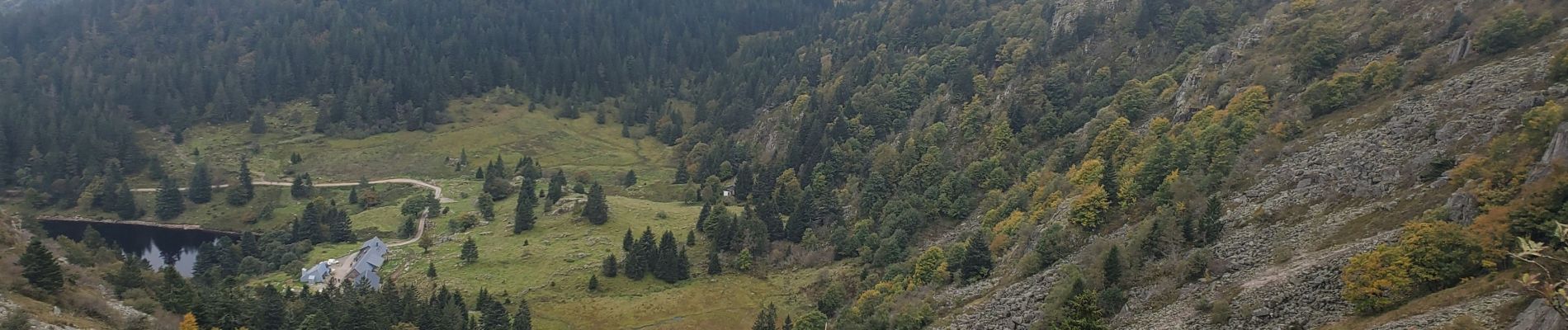
Soultzeren 4 lacs blanc vert noir truites 17kms 722m

Danielba
User GUIDE
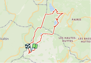

Length
16.4 km

Max alt
1304 m

Uphill gradient
706 m
Km-Effort
26 km

Min alt
950 m

Downhill gradient
705 m
Boucle
Yes
Creation date :
2024-10-05 08:30:37.958
Updated on :
2024-10-05 17:49:56.411
5h36
Difficulty : Medium

FREE GPS app for hiking
 SityTrail
IGN / Geographical institutes
SityTrail Plus
The world is yours!
About
Trail Walking of 16.4 km to be discovered at Grand Est, Haut-Rhin, Soultzeren. This trail is proposed by Danielba .
Photos


Positioning
Country:
France
Region :
Grand Est
Department/Province :
Haut-Rhin
Municipality :
Soultzeren
Location:
Unknown
Start:(Dec)
Start:(UTM)
355784 ; 5327719 (32U) N.
Comments