Trail Walking Bernis - BERNIS 30 -  NAGES ET SOLORGUES - ST DIONISY - LANGLADE - Photo

BERNIS 30 - NAGES ET SOLORGUES - ST DIONISY - LANGLADE

 jeff66
jeff66

User

© OpenStreetMap contributors
Length
Length
16.2 km
Max alt
Max alt
178 m
Uphill gradient
Uphill gradient
320 m
Km-Effort
Km-Effort  
21 km
Min alt
Min alt
52 m
Downhill gradient
Downhill gradient
320 m
Boucle
Boucle
Yes
Creation date :
2015-05-21 00:00:00.0
Updated on :
2015-05-21 00:00:00.0

(1 Reviews)

Walking
Walking
3h09
Difficulty : Difficult

Scan this QR Code to open this trail in the SityTrail application

FREE GPS app for hiking

Logo SityTrail SityTrail

IGN / Geographical institutes

Download SityTrail from the App Store Download SityTrail from Google Play

Logo SityTrail SityTrail World

The world is yours!

Download SityTrail from the App Store Download SityTrail from Google Play Download SityTrail on Huawei AppGallery

About

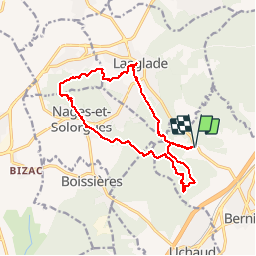
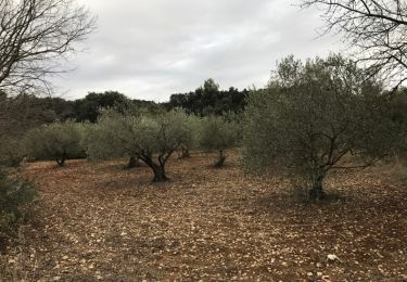
Trail Walking of 16.2 km to be discovered at Occitania, Gard, Bernis. This trail is proposed by jeff66.

Description

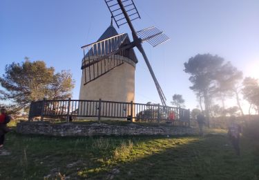
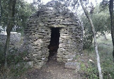
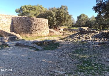
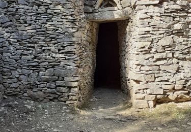
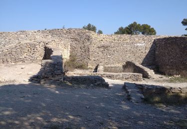
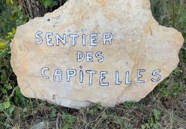
BERNIS 30 -  les 4 chemins - chemin du rossignol - fromagerie - bois de BERNIS - DFCI B33 - Rossignol - piste entre les pins - Font de Chechay - l'Olivel - Sentier des capitelles du grand bois - les fées - c. La. Picholine, de l'enclos, de Roger, des iris - Barbieres - arbousiers - c. Du ponant, du chêne, des amis de BERNIS - chauvet - clapas - aiguier des rouges gorges - c. La pequelete - bois de Bernard - Sentier botanique - c. du grand bois - DFCI B32 - carrefour de la poste - vue sur le chateau de Boissières - NAGES ET SOLORGUES - presbytère - Oppidum de NAGES - vue sur Calvisson - bois de l'oppodum - oppidum de Roque de Viou - ST DIONISY - vue sur Clarensac - point de vue - LANGLADE - lavoir - les lavandières - le coin du loup - temple - le moulin de LANGLADE - chemin de tres patas - DFCI B33 -

Elevation profile

Photos

25 photos in total. Please click on a photo to see them all in the gallery.

Positioning

Country:
France
Region :
Occitania
Department/Province :
Gard
Municipality :
Bernis
Location:
Unknown
Start:(UTM)
602153 ; 4848575 (31T) N.

Comments

Please log in to post a review or rate the element


Trails nearby

Trail Walking Langlade - Langlade - Voie-verte Fontaine - Photo
Walking
rando30129

Walking

Medium
(1)
Langlade, Occitania, Gard, France
7.8 km | 9.1 km-effort
2h 4min
Yes
Trail Walking Saint-Dionisy - Opidum de Nages - Photo
Walking
CAMBON

Walking

Easy
(2)
Saint-Dionisy, Occitania, Gard, France
6.8 km | 9.4 km-effort
2h 0min
Yes
Trail Walking Langlade - NAGES ET SOLORGUES - LA GRAND COMBE - 16.5Km - 04h30 - Dénivelé 340 m - Photo
Walking
dansmabulle

Walking

Medium
(1)
Langlade, Occitania, Gard, France
16.7 km | 22 km-effort
4h 34min
Yes
Trail Walking Nages-et-Solorgues - nages-langlades - Photo
Walking
v.rabot

Walking

Medium
Nages-et-Solorgues, Occitania, Gard, France
14.8 km | 18.9 km-effort
5h 18min
Yes
Trail Walking Saint-Dionisy - Saint Dionisy -Oppidum - Nages - Photo
Walking
rando30129

Walking

Difficult
(1)
Saint-Dionisy, Occitania, Gard, France
11 km | 15.7 km-effort
3h 9min
Yes
Trail Walking Langlade - Langlade- les Capitelles - Photo
Walking
Manoune

Walking

Medium
Langlade, Occitania, Gard, France
15 km | 19.1 km-effort
5h 5min
Yes
Trail Walking Nages-et-Solorgues - 30  nages et solorgues langlade - Photo
Walking
himba26100

Walking

Medium
Nages-et-Solorgues, Occitania, Gard, France
17 km | 22 km-effort
6h 4min
Yes
Trail Walking Bernis - Capitelles de Bernis - Photo
Walking
kephas

Walking

Bernis, Occitania, Gard, France
5.3 km | 6.6 km-effort
4h 3min
Yes
Trail Walking Milhaud - Capitelles de Milhaud - Photo
Walking
kephas

Walking

Very easy
(1)
Milhaud, Occitania, Gard, France
9 km | 10.3 km-effort
4h 35min
Yes


Close
My subscriptions