


Les Cadières de Brandis

GeorgesV.
User
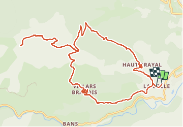

Length
15.4 km

Max alt
1558 m

Uphill gradient
877 m
Km-Effort
27 km

Min alt
743 m

Downhill gradient
887 m
Boucle
Yes
Creation date :
2024-10-09 06:52:50.0
Updated on :
2024-10-14 21:38:39.501
6h10
Difficulty : Very difficult

FREE GPS app for hiking
 SityTrail
IGN / Geographical institutes
SityTrail Plus
The world is yours!
About
Trail Walking of 15.4 km to be discovered at Provence-Alpes-Côte d'Azur, Alpes-de-Haute-Provence, Castellane. This trail is proposed by GeorgesV..
Positioning
Country:
France
Region :
Provence-Alpes-Côte d'Azur
Department/Province :
Alpes-de-Haute-Provence
Municipality :
Castellane
Location:
Unknown
Start:(Dec)
Start:(UTM)
298236 ; 4856943 (32T) N.
Comments