


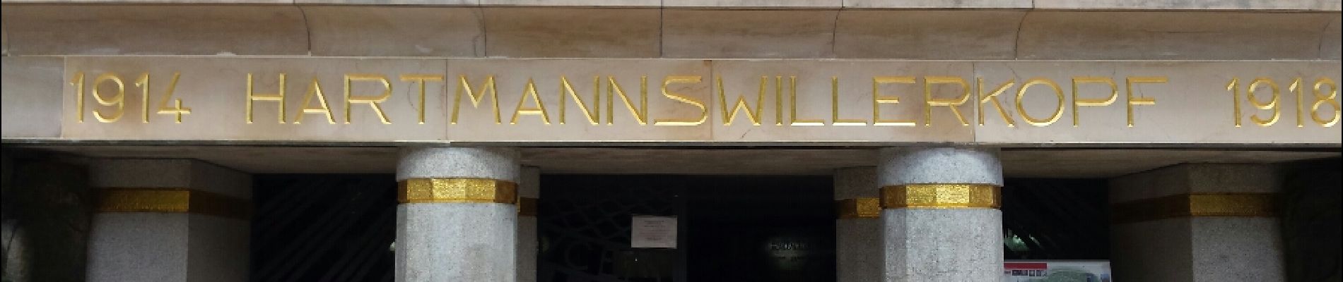
Hartmannswillerkopf - Circuit anneau bleu

VacheKiri67
User
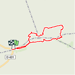

Length
3.7 km

Max alt
952 m

Uphill gradient
164 m
Km-Effort
5.9 km

Min alt
833 m

Downhill gradient
166 m
Boucle
Yes
Creation date :
2015-05-19 00:00:00.0
Updated on :
2015-05-19 00:00:00.0
1h37
Difficulty : Medium

FREE GPS app for hiking
 SityTrail
IGN / Geographical institutes
SityTrail Plus
The world is yours!
About
Trail Walking of 3.7 km to be discovered at Grand Est, Haut-Rhin, Soultz-Haut-Rhin. This trail is proposed by VacheKiri67.
Description
Faite le 17/05/2015 avec notre fils de 10 ans. Bonnes chaussures nécessaires.
Photos


26 photos in total. Please click on a photo to see them all in the gallery.
Positioning
Country:
France
Region :
Grand Est
Department/Province :
Haut-Rhin
Municipality :
Soultz-Haut-Rhin
Location:
Unknown
Start:(Dec)
Start:(UTM)
361501 ; 5302257 (32T) N.
Comments
Ce parcours emprunte d'anciennes tranchées.