


Hartmannswillerkopf - Circuit découverte

VacheKiri67
User
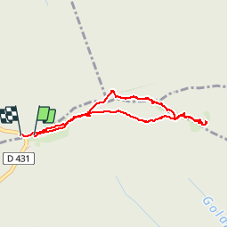

Length
3.6 km

Max alt
952 m

Uphill gradient
118 m
Km-Effort
5.2 km

Min alt
880 m

Downhill gradient
116 m
Boucle
Yes
Creation date :
2015-05-17 00:00:00.0
Updated on :
2015-05-17 00:00:00.0
1h46
Difficulty : Easy

FREE GPS app for hiking
 SityTrail
IGN / Geographical institutes
SityTrail Plus
The world is yours!
About
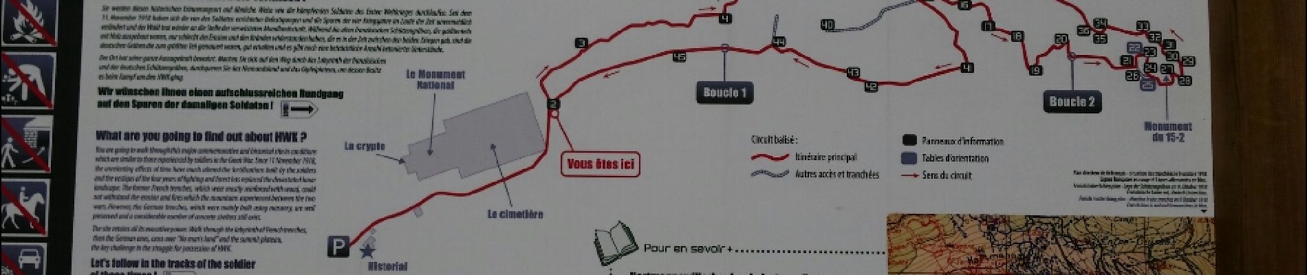
Trail Walking of 3.6 km to be discovered at Grand Est, Haut-Rhin, Soultz-Haut-Rhin. This trail is proposed by VacheKiri67.
Description
Faite le 17/05/2015 avec notre fils de 10 ans. Nous l'avons ensuite couplée avec un second tour en empruntant l'anneau bleu.
Photos


24 photos in total. Please click on a photo to see them all in the gallery.


Positioning
Country:
France
Region :
Grand Est
Department/Province :
Haut-Rhin
Municipality :
Soultz-Haut-Rhin
Location:
Unknown
Start:(Dec)
Start:(UTM)
361590 ; 5302255 (32T) N.
Comments
Parcours de mémoire très instructif.