


mantet col del pal boucle

FAUCET
User
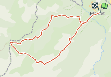

Length
12.3 km

Max alt
2348 m

Uphill gradient
956 m
Km-Effort
25 km

Min alt
1477 m

Downhill gradient
960 m
Boucle
Yes
Creation date :
2024-10-16 12:55:23.396
Updated on :
2024-10-16 12:55:26.248
5h42
Difficulty : Very difficult

FREE GPS app for hiking
 SityTrail
IGN / Geographical institutes
SityTrail Plus
The world is yours!
About
Trail Walking of 12.3 km to be discovered at Occitania, Pyrénées-Orientales, Mantet. This trail is proposed by FAUCET.
Positioning
Country:
France
Region :
Occitania
Department/Province :
Pyrénées-Orientales
Municipality :
Mantet
Location:
Unknown
Start:(Dec)
Start:(UTM)
443141 ; 4703044 (31T) N.
Comments