


tempete

Liebeaux
User
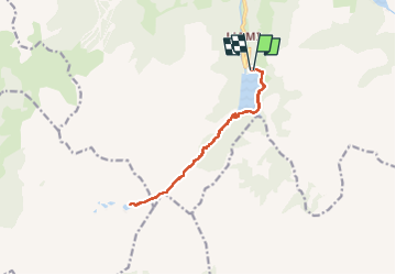

Length
12.8 km

Max alt
2168 m

Uphill gradient
795 m
Km-Effort
23 km

Min alt
1539 m

Downhill gradient
800 m
Boucle
Yes
Creation date :
2024-10-17 07:19:27.664
Updated on :
2024-10-17 14:24:57.128
6h41
Difficulty : Very difficult

FREE GPS app for hiking
 SityTrail
IGN / Geographical institutes
SityTrail Plus
The world is yours!
About
Trail Walking of 12.8 km to be discovered at Auvergne-Rhône-Alpes, Savoy, Beaufort. This trail is proposed by Liebeaux.
Positioning
Country:
France
Region :
Auvergne-Rhône-Alpes
Department/Province :
Savoy
Municipality :
Beaufort
Location:
Unknown
Start:(Dec)
Start:(UTM)
311532 ; 5058136 (32T) N.
Comments