


coiroux

Nordic33
User GUIDE

Length
18.2 km

Max alt
497 m

Uphill gradient
469 m
Km-Effort
24 km

Min alt
253 m

Downhill gradient
471 m
Boucle
Yes
Creation date :
2024-10-19 07:27:50.628
Updated on :
2024-10-19 14:13:02.836
6h43
Difficulty : Very difficult

FREE GPS app for hiking
 SityTrail
IGN / Geographical institutes
SityTrail Plus
The world is yours!
About
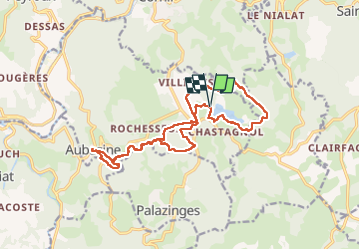
Trail Walking of 18.2 km to be discovered at New Aquitaine, Corrèze, Aubazines. This trail is proposed by Nordic33.
Photos


Positioning
Country:
France
Region :
New Aquitaine
Department/Province :
Corrèze
Municipality :
Aubazines
Location:
Unknown
Start:(Dec)
Start:(UTM)
398695 ; 5004272 (31T) N.
Comments