


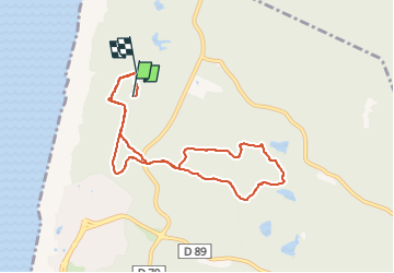
boucle bois des casernes

PVERTICAL
User

Length
8.8 km

Max alt
57 m

Uphill gradient
115 m
Km-Effort
10.4 km

Min alt
6 m

Downhill gradient
124 m
Boucle
No
Creation date :
2024-11-02 07:45:18.857
Updated on :
2024-11-04 19:20:00.912
56m
Difficulty : Medium

FREE GPS app for hiking
 SityTrail
IGN / Geographical institutes
SityTrail Plus
The world is yours!
About
Trail Running of 8.8 km to be discovered at New Aquitaine, Landes, Seignosse. This trail is proposed by PVERTICAL.
Description
DEPUIS LE PARKING DE LA PLAGE DES CASERNES
Positioning
Country:
France
Region :
New Aquitaine
Department/Province :
Landes
Municipality :
Seignosse
Location:
Unknown
Start:(Dec)
Start:(UTM)
627036 ; 4842240 (30T) N.
Comments