


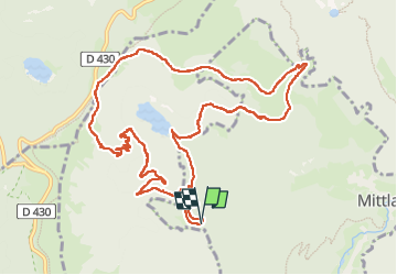
Tour de l'Altenweiher

LaurentGILG
User

Length
12.7 km

Max alt
1259 m

Uphill gradient
603 m
Km-Effort
21 km

Min alt
699 m

Downhill gradient
603 m
Boucle
Yes
Creation date :
2024-11-03 08:01:40.124
Updated on :
2024-11-03 18:20:25.613
5h30
Difficulty : Difficult

FREE GPS app for hiking
 SityTrail
IGN / Geographical institutes
SityTrail Plus
The world is yours!
About
Trail Walking of 12.7 km to be discovered at Grand Est, Haut-Rhin, Mittlach. This trail is proposed by LaurentGILG.
Positioning
Country:
France
Region :
Grand Est
Department/Province :
Haut-Rhin
Municipality :
Mittlach
Location:
Unknown
Start:(Dec)
Start:(UTM)
350977 ; 5318394 (32U) N.
Comments