


BAUGES: BANC PLAT via REPOSOIR - BORNETTE - REFUGE COMBE

djeepee74
User
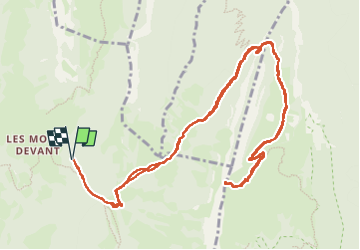

Length
15.3 km

Max alt
1887 m

Uphill gradient
904 m
Km-Effort
27 km

Min alt
1106 m

Downhill gradient
901 m
Boucle
Yes
Creation date :
2024-11-09 07:41:49.692
Updated on :
2024-11-10 10:21:52.926
6h13
Difficulty : Difficult

FREE GPS app for hiking
 SityTrail
IGN / Geographical institutes
SityTrail Plus
The world is yours!
About
Trail Walking of 15.3 km to be discovered at Auvergne-Rhône-Alpes, Savoy, Bellecombe-en-Bauges. This trail is proposed by djeepee74.
Description
A/R... live du 20241109.
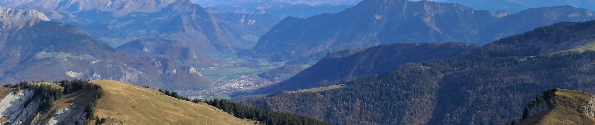
Pointe de Banc Plat (1907 m.): Un des plus beaux panoramas du massif des Bauges !
Photos


Positioning
Country:
France
Region :
Auvergne-Rhône-Alpes
Department/Province :
Savoy
Municipality :
Bellecombe-en-Bauges
Location:
Unknown
Start:(Dec)
Start:(UTM)
279718 ; 5068279 (32T) N.
Comments