


ValleeThur_2024-11-09

Phil.PES
User
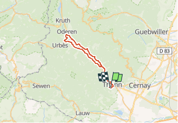

Length
37 km

Max alt
472 m

Uphill gradient
530 m
Km-Effort
44 km

Min alt
335 m

Downhill gradient
529 m
Boucle
Yes
Creation date :
2024-11-09 13:21:22.738
Updated on :
2024-11-09 15:51:26.729
2h20
Difficulty : Very difficult

FREE GPS app for hiking
 SityTrail
IGN / Geographical institutes
SityTrail Plus
The world is yours!
About
Trail Mountain bike of 37 km to be discovered at Grand Est, Haut-Rhin, Thann. This trail is proposed by Phil.PES.
Positioning
Country:
France
Region :
Grand Est
Department/Province :
Haut-Rhin
Municipality :
Thann
Location:
Unknown
Start:(Dec)
Start:(UTM)
357550 ; 5296236 (32T) N.
Comments