Nieul_Terre_Mer

jagarnier
User GUIDE
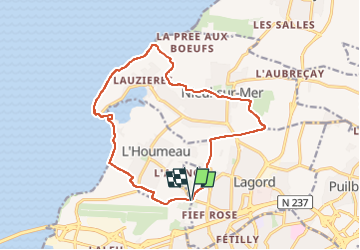

Length
15.5 km

Max alt
28 m

Uphill gradient
84 m
Km-Effort
16.6 km

Min alt
-3 m

Downhill gradient
83 m
Boucle
Yes
Creation date :
2024-11-16 08:44:40.882
Updated on :
2024-11-16 14:04:40.602
4h45
Difficulty : Medium

FREE GPS app for hiking
 SityTrail
IGN / Geographical institutes
SityTrail Plus
The world is yours!
About
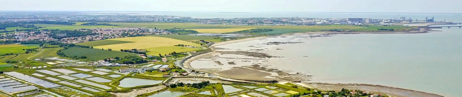
Trail Walking of 15.5 km to be discovered at New Aquitaine, Charente-Maritime, Lagord. This trail is proposed by jagarnier.
Photos

Positioning
Country:
France
Region :
New Aquitaine
Department/Province :
Charente-Maritime
Municipality :
Lagord
Location:
Unknown
Start:(Dec)
Start:(UTM)
641011 ; 5115885 (30T) N.
Comments