


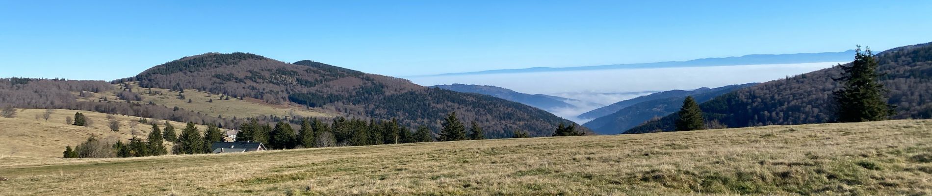
24 11 16 Autour du Markstein

jmbilger
User
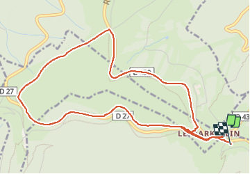

Length
5.8 km

Max alt
1223 m

Uphill gradient
109 m
Km-Effort
7.3 km

Min alt
1159 m

Downhill gradient
119 m
Boucle
Yes
Creation date :
2024-11-16 10:12:00.0
Updated on :
2024-11-16 13:39:51.31
1h36
Difficulty : Unknown

FREE GPS app for hiking
 SityTrail
IGN / Geographical institutes
SityTrail Plus
The world is yours!
About
Trail Walking of 5.8 km to be discovered at Grand Est, Haut-Rhin, Ranspach. This trail is proposed by jmbilger.
Photos

Positioning
Country:
France
Region :
Grand Est
Department/Province :
Haut-Rhin
Municipality :
Ranspach
Location:
Unknown
Start:(Dec)
Start:(UTM)
353109 ; 5309619 (32T) N.
Comments