


Barthes d Ardanavy

Papamoju
User
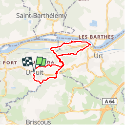

Length
13.1 km

Max alt
31 m

Uphill gradient
99 m
Km-Effort
14.4 km

Min alt
-1 m

Downhill gradient
100 m
Boucle
Yes
Creation date :
2015-05-31 00:00:00.0
Updated on :
2015-05-31 00:00:00.0
3h06
Difficulty : Easy

FREE GPS app for hiking
 SityTrail
IGN / Geographical institutes
SityTrail Plus
The world is yours!
About
Trail Walking of 13.1 km to be discovered at New Aquitaine, Pyrénées-Atlantiques, Urcuit. This trail is proposed by Papamoju.
Positioning
Country:
France
Region :
New Aquitaine
Department/Province :
Pyrénées-Atlantiques
Municipality :
Urcuit
Location:
Unknown
Start:(Dec)
Start:(UTM)
634507 ; 4816080 (30T) N.
Comments
Yrès agréable par grosse chaleur: ombre + eau + pas de côte