


rando aigle

c.zeig
User

Length
6.1 km

Max alt
770 m

Uphill gradient
82 m
Km-Effort
7.9 km

Min alt
554 m

Downhill gradient
274 m
Boucle
No
Creation date :
2024-07-23 08:07:49.903
Updated on :
2024-12-30 16:02:36.154
13h51
Difficulty : Medium

FREE GPS app for hiking
 SityTrail
IGN / Geographical institutes
SityTrail Plus
The world is yours!
About
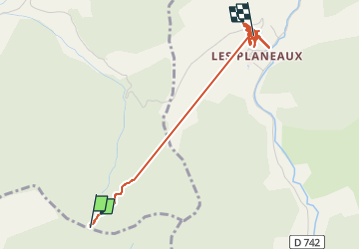
Trail Walking of 6.1 km to be discovered at Auvergne-Rhône-Alpes, Drôme, Chamaloc. This trail is proposed by c.zeig.
Positioning
Country:
France
Region :
Auvergne-Rhône-Alpes
Department/Province :
Drôme
Municipality :
Chamaloc
Location:
Unknown
Start:(Dec)
Start:(UTM)
689187 ; 4961576 (31T) N.
Comments