


lussac st emilion

Gbreuilh
User

Length
10.9 km

Max alt
84 m

Uphill gradient
131 m
Km-Effort
12.7 km

Min alt
41 m

Downhill gradient
132 m
Boucle
Yes
Creation date :
2025-01-08 08:32:55.748
Updated on :
2025-01-08 11:36:46.548
2h59
Difficulty : Difficult

FREE GPS app for hiking
 SityTrail
IGN / Geographical institutes
SityTrail Plus
The world is yours!
About
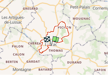
Trail Walking of 10.9 km to be discovered at New Aquitaine, Gironde, Lussac. This trail is proposed by Gbreuilh.
Positioning
Country:
France
Region :
New Aquitaine
Department/Province :
Gironde
Municipality :
Lussac
Location:
Unknown
Start:(Dec)
Start:(UTM)
729079 ; 4981421 (30T) N.
Comments