


la colle cadieres de brandis 20kms 1086m

Danielba
User GUIDE

Length
19.6 km

Max alt
1558 m

Uphill gradient
991 m
Km-Effort
33 km

Min alt
759 m

Downhill gradient
991 m
Boucle
Yes
Creation date :
2025-01-19 07:17:23.677
Updated on :
2025-01-19 18:07:18.827
7h44
Difficulty : Medium

FREE GPS app for hiking
 SityTrail
IGN / Geographical institutes
SityTrail Plus
The world is yours!
About
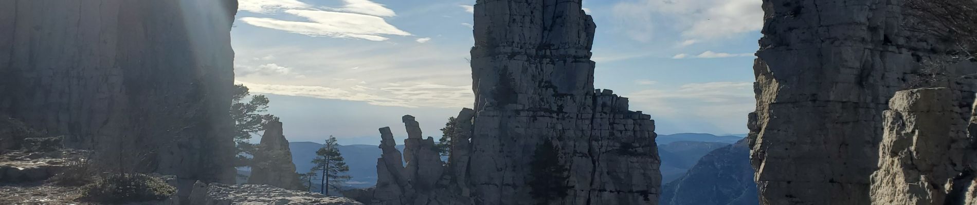
Trail Walking of 19.6 km to be discovered at Provence-Alpes-Côte d'Azur, Alpes-de-Haute-Provence, Castellane. This trail is proposed by Danielba .
Photos


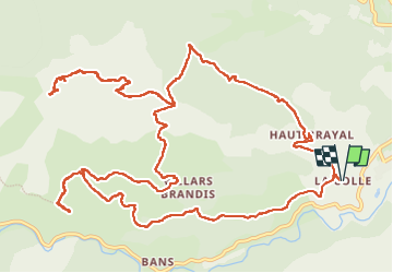
Positioning
Country:
France
Region :
Provence-Alpes-Côte d'Azur
Department/Province :
Alpes-de-Haute-Provence
Municipality :
Castellane
Location:
Unknown
Start:(Dec)
Start:(UTM)
298250 ; 4856946 (32T) N.
Comments
Magtnifique !