


C0rrancon Herbouilly

taguette
User
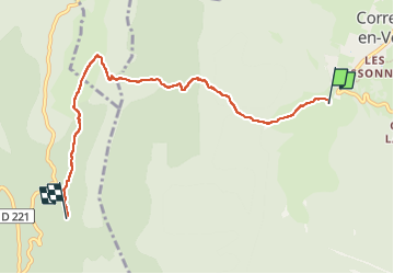

Length
6.3 km

Max alt
1461 m

Uphill gradient
361 m
Km-Effort
10.6 km

Min alt
1159 m

Downhill gradient
202 m
Boucle
No
Creation date :
2025-01-20 12:42:53.67
Updated on :
2025-01-21 17:32:48.225
3h44
Difficulty : Medium

FREE GPS app for hiking
 SityTrail
IGN / Geographical institutes
SityTrail Plus
The world is yours!
About
Trail Walking of 6.3 km to be discovered at Auvergne-Rhône-Alpes, Isère, Corrençon-en-Vercors. This trail is proposed by taguette.
Positioning
Country:
France
Region :
Auvergne-Rhône-Alpes
Department/Province :
Isère
Municipality :
Corrençon-en-Vercors
Location:
Unknown
Start:(Dec)
Start:(UTM)
698269 ; 4988621 (31T) N.
Comments