


ARCA FOUCHY

Gatge
User

Length
7.2 km

Max alt
743 m

Uphill gradient
291 m
Km-Effort
11.1 km

Min alt
578 m

Downhill gradient
290 m
Boucle
Yes
Creation date :
2025-01-23 13:04:09.642
Updated on :
2025-01-23 19:28:28.219
2h31
Difficulty : Medium

FREE GPS app for hiking
 SityTrail
IGN / Geographical institutes
SityTrail Plus
The world is yours!
About
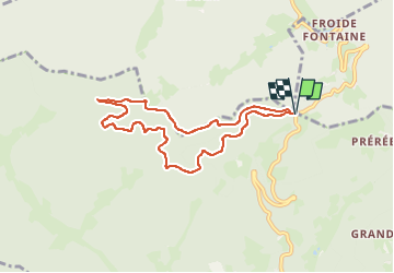
Trail Walking of 7.2 km to be discovered at Grand Est, Haut-Rhin, Rombach-le-Franc. This trail is proposed by Gatge.
Positioning
Country:
France
Region :
Grand Est
Department/Province :
Haut-Rhin
Municipality :
Rombach-le-Franc
Location:
Unknown
Start:(Dec)
Start:(UTM)
370978 ; 5351631 (32U) N.
Comments