


2025 01 Huit km au desus de Wintzfelden

staubalex
User
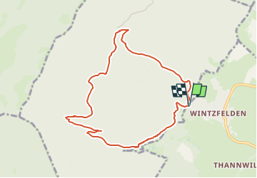

Length
8.4 km

Max alt
841 m

Uphill gradient
468 m
Km-Effort
14.6 km

Min alt
412 m

Downhill gradient
468 m
Boucle
Yes
Creation date :
2025-01-28 06:18:24.967
Updated on :
2025-01-28 06:21:29.968
3h19
Difficulty : Difficult

FREE GPS app for hiking
 SityTrail
IGN / Geographical institutes
SityTrail Plus
The world is yours!
About
Trail Walking of 8.4 km to be discovered at Grand Est, Haut-Rhin, Soultzmatt. This trail is proposed by staubalex.
Positioning
Country:
France
Region :
Grand Est
Department/Province :
Haut-Rhin
Municipality :
Soultzmatt
Location:
Unknown
Start:(Dec)
Start:(UTM)
364853 ; 5315442 (32T) N.
Comments