


73V Valmenier1800/lac_vert/retour

trietsch
User
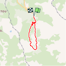

Length
9.5 km

Max alt
2096 m

Uphill gradient
492 m
Km-Effort
16.1 km

Min alt
1645 m

Downhill gradient
490 m
Boucle
Yes
Creation date :
2015-06-15 00:00:00.0
Updated on :
2024-09-07 12:33:18.525
4h00
Difficulty : Medium

FREE GPS app for hiking
 SityTrail
IGN / Geographical institutes
SityTrail Plus
The world is yours!
About
Trail Walking of 9.5 km to be discovered at Auvergne-Rhône-Alpes, Savoy, Valmeinier. This trail is proposed by trietsch.
Positioning
Country:
France
Region :
Auvergne-Rhône-Alpes
Department/Province :
Savoy
Municipality :
Valmeinier
Location:
Unknown
Start:(Dec)
Start:(UTM)
303002 ; 5005316 (32T) N.
Comments
Bonne application ??