


73V Dép Lachat Le tour des 4 lacs

trietsch
User
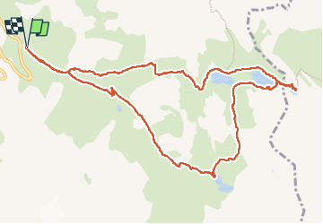

Length
13.3 km

Max alt
2583 m

Uphill gradient
686 m
Km-Effort
22 km

Min alt
1979 m

Downhill gradient
685 m
Boucle
Yes
Creation date :
2015-06-18 00:00:00.0
Updated on :
2015-06-18 00:00:00.0
4h41
Difficulty : Difficult

FREE GPS app for hiking
 SityTrail
IGN / Geographical institutes
SityTrail Plus
The world is yours!
About
Trail Walking of 13.3 km to be discovered at Auvergne-Rhône-Alpes, Savoy, Valloire. This trail is proposed by trietsch.
Photos


31 photos in total. Please click on a photo to see them all in the gallery.
Positioning
Country:
France
Region :
Auvergne-Rhône-Alpes
Department/Province :
Savoy
Municipality :
Valloire
Location:
Unknown
Start:(Dec)
Start:(UTM)
298298 ; 4996132 (32T) N.
Comments