Trail Walking Brussieu - La Giraudière à Vaugneray - Photo

La Giraudière à Vaugneray

© OpenStreetMap contributors
Length
Length
15.2 km
Max alt
Max alt
859 m
Uphill gradient
Uphill gradient
625 m
Km-Effort
Km-Effort  
23 km
Min alt
Min alt
305 m
Downhill gradient
Downhill gradient
515 m
Boucle
Boucle
No
Creation date :
2015-06-19 00:00:00.0
Updated on :
2015-06-19 00:00:00.0

(0 Reviews)

Walking
Walking
4h52
Difficulty : Medium

Scan this QR Code to open this trail in the SityTrail application

FREE GPS app for hiking

Logo SityTrail SityTrail

IGN / Geographical institutes

Download SityTrail from the App Store Download SityTrail from Google Play

Logo SityTrail SityTrail World

The world is yours!

Download SityTrail from the App Store Download SityTrail from Google Play Download SityTrail on Huawei AppGallery

About

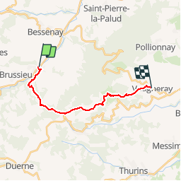
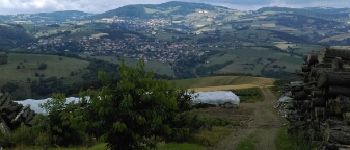
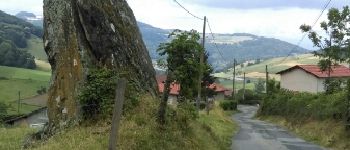
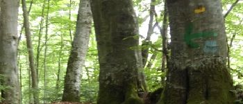
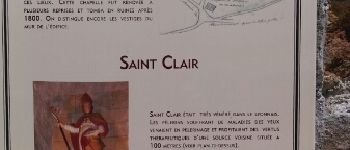
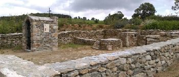
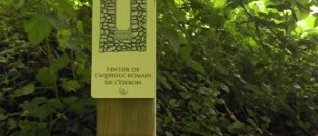
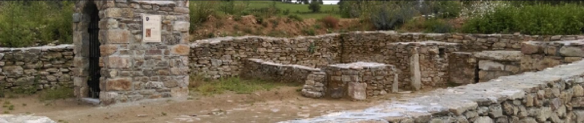
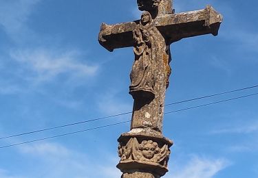
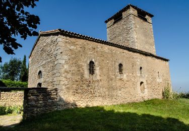
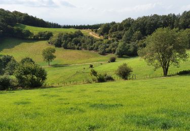
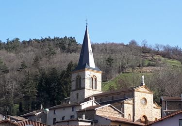
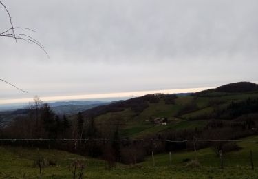
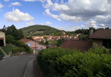
Trail Walking of 15.2 km to be discovered at Auvergne-Rhône-Alpes, Rhône, Brussieu. This trail is proposed by Trotte-menu.

Description

Ce parcours s'effectue au départ de Lyon avec les bus du Rhône.
Départ Gorge de Loup Ligne 42 arrêt la Giraudière.
Retour Ligne 47 arrêt Craponne centre puis TCL, ligne C24 jusqu'à Gorge de Loup.

Elevation profile

Photos

Points of interest

Point of interest Courzieu - Point 1 - Photo
Trotte-menu
COURZIEU 
Point of interest Courzieu - Petit lavoir - Photo
Trotte-menu
COURZIEU 
Point of interest Courzieu - Belle vue - Photo
Trotte-menu
COURZIEU 
Point of interest Courzieu - Roche des Avergues - Photo
Trotte-menu
Point of interest Courzieu - Racines de hêtres - Photo
Trotte-menu
Point of interest Courzieu - Beau hêtre - Photo
Trotte-menu
COURZIEU 
Point of interest Courzieu - saint Clair Point 8 - Photo
Trotte-menu
Point of interest Courzieu - Chapelle Saint-Clair - Photo
Trotte-menu
Point of interest Vaugneray - sentier aqueduc romain terrine Point 11 - Photo
Trotte-menu

Positioning

Country:
France
Region :
Auvergne-Rhône-Alpes
Department/Province :
Rhône
Municipality :
Brussieu
Location:
Unknown
Start:(UTM)
620345 ; 5067675 (31T) N.

Trails nearby

Trail Walking Courzieu - 2023-05-11_18h58m29_Fiche Verte n°5_Courzieu - Photo
Walking
daniellebou

Walking

Difficult
(1)
Courzieu, Auvergne-Rhône-Alpes, Rhône, France
9 km | 15 km-effort
3h 23min
Yes
Trail Walking Bibost - RANDO BIBOST - Photo
Walking
JULIENANDRE

Walking

Medium
Bibost, Auvergne-Rhône-Alpes, Rhône, France
16.5 km | 24 km-effort
5h 22min
Yes
Trail On foot Yzeron - Circuit de Py Froid - Photo
On foot
PRO

On foot

Easy
Yzeron, Auvergne-Rhône-Alpes, Rhône, France
7.8 km | 10.9 km-effort
2h 27min
Yes
Trail Walking Yzeron - Yzeron - Les hauteurs d'Yzeron - Photo
Walking
Sigmut

Walking

Easy
Yzeron, Auvergne-Rhône-Alpes, Rhône, France
7.4 km | 10.3 km-effort
2h 3min
Yes
Trail Walking Montromant -  Montromant la Croix des brosses (12 km - D. 504 m) - Photo
Walking
Thomasdanielle

Walking

Medium
Montromant, Auvergne-Rhône-Alpes, Rhône, France
12.1 km | 18.8 km-effort
4h 17min
Yes
Trail Walking Brullioles - De Bruliolles à Montrottier - Photo
Walking
mimi69670

Walking

Easy
Brullioles, Auvergne-Rhône-Alpes, Rhône, France
11.8 km | 16.8 km-effort
2h 52min
Yes
Trail Walking Yzeron - Izeron - Des cascades à la Madonne - Photo
Walking
Sigmut

Walking

Easy
Yzeron, Auvergne-Rhône-Alpes, Rhône, France
7.1 km | 10.8 km-effort
3h 33min
Yes
Trail Walking Yzeron - Yzeron - Photo
Walking
algecko

Walking

Difficult
(1)
Yzeron, Auvergne-Rhône-Alpes, Rhône, France
12.5 km | 20 km-effort
3h 40min
Yes
Trail Walking Brussieu - 3 brussieu 17.6 km +570m - Photo
Walking
christiane69

Walking

Very easy
(1)
Brussieu, Auvergne-Rhône-Alpes, Rhône, France
17.6 km | 25 km-effort
5h 47min
Yes


Close
My subscriptions