


Le Cuyalaret (Anéou 64)

yvesdelafforest
User
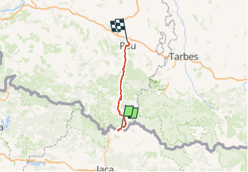

Length
83 km

Max alt
2266 m

Uphill gradient
1240 m
Km-Effort
105 km

Min alt
174 m

Downhill gradient
2748 m
Boucle
No
Creation date :
2025-02-13 09:33:43.497
Updated on :
2025-02-13 17:52:55.57
8h17
Difficulty : Very easy

FREE GPS app for hiking
 SityTrail
IGN / Geographical institutes
SityTrail Plus
The world is yours!
About
Trail Touring skiing of 83 km to be discovered at New Aquitaine, Pyrénées-Atlantiques, Laruns. This trail is proposed by yvesdelafforest.
Positioning
Country:
France
Region :
New Aquitaine
Department/Province :
Pyrénées-Atlantiques
Municipality :
Laruns
Location:
Unknown
Start:(Dec)
Start:(UTM)
711071 ; 4743531 (30T) N.
Comments