


evtt 4 - 20km - Chauffour-Paunac-19180874

Gpoujade
User
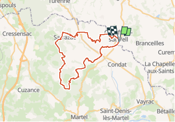

Length
32 km

Max alt
321 m

Uphill gradient
789 m
Km-Effort
43 km

Min alt
124 m

Downhill gradient
786 m
Boucle
Yes
Creation date :
2025-02-14 16:38:46.678
Updated on :
2025-02-15 09:32:31.138
2h56
Difficulty : Very difficult

FREE GPS app for hiking
 SityTrail
IGN / Geographical institutes
SityTrail Plus
The world is yours!
About
Trail Mountain bike of 32 km to be discovered at New Aquitaine, Corrèze, Chauffour-sur-Vell. This trail is proposed by Gpoujade.
Description
Boucle via Cavagnac et Les 4 Rtes Du Lot
Positioning
Country:
France
Region :
New Aquitaine
Department/Province :
Corrèze
Municipality :
Chauffour-sur-Vell
Location:
Unknown
Start:(Dec)
Start:(UTM)
394914 ; 4985155 (31T) N.
Comments