


Kruth le lac

adamfv
User
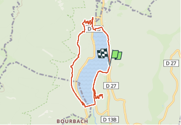

Length
8.7 km

Max alt
735 m

Uphill gradient
382 m
Km-Effort
13.7 km

Min alt
528 m

Downhill gradient
380 m
Boucle
Yes
Creation date :
2025-02-16 11:19:10.0
Updated on :
2025-02-16 15:05:51.038
3h45
Difficulty : Difficult

FREE GPS app for hiking
 SityTrail
IGN / Geographical institutes
SityTrail Plus
The world is yours!
About
Trail Walking of 8.7 km to be discovered at Grand Est, Haut-Rhin, Kruth. This trail is proposed by adamfv.
Description
Kruth le lac
Positioning
Country:
France
Region :
Grand Est
Department/Province :
Haut-Rhin
Municipality :
Kruth
Location:
Unknown
Start:(Dec)
Start:(UTM)
347825 ; 5313390 (32T) N.
Comments