


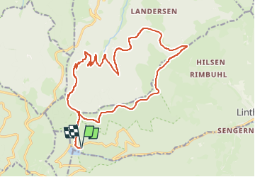
Lac de la lauch - Col de Hilsen

Alain28/01
User

Length
20 km

Max alt
1267 m

Uphill gradient
953 m
Km-Effort
33 km

Min alt
738 m

Downhill gradient
954 m
Boucle
Yes
Creation date :
2025-02-17 16:19:56.954
Updated on :
2025-02-17 16:21:24.659
7h29
Difficulty : Very difficult

FREE GPS app for hiking
 SityTrail
IGN / Geographical institutes
SityTrail Plus
The world is yours!
About
Trail Walking of 20 km to be discovered at Grand Est, Haut-Rhin, Linthal. This trail is proposed by Alain28/01.
Positioning
Country:
France
Region :
Grand Est
Department/Province :
Haut-Rhin
Municipality :
Linthal
Location:
Unknown
Start:(Dec)
Start:(UTM)
354104 ; 5311093 (32T) N.
Comments