


Vignonnet

Gbreuilh
User
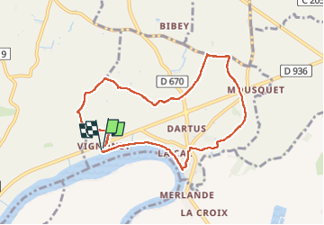

Length
8.2 km

Max alt
12 m

Uphill gradient
32 m
Km-Effort
8.7 km

Min alt
2 m

Downhill gradient
34 m
Boucle
Yes
Creation date :
2025-02-20 12:56:48.288
Updated on :
2025-02-20 15:25:04.247
2h27
Difficulty : Medium

FREE GPS app for hiking
 SityTrail
IGN / Geographical institutes
SityTrail Plus
The world is yours!
About
Trail Walking of 8.2 km to be discovered at New Aquitaine, Gironde, Vignonet. This trail is proposed by Gbreuilh.
Positioning
Country:
France
Region :
New Aquitaine
Department/Province :
Gironde
Municipality :
Vignonet
Location:
Unknown
Start:(Dec)
Start:(UTM)
724245 ; 4969528 (30T) N.
Comments