


73Va/Mottets/cerces/rochilles/Mottets

trietsch
User
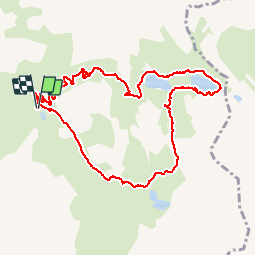

Length
10.8 km

Max alt
2583 m

Uphill gradient
509 m
Km-Effort
17.6 km

Min alt
2137 m

Downhill gradient
509 m
Boucle
Yes
Creation date :
2015-06-21 00:00:00.0
Updated on :
2024-09-07 12:41:57.052
3h41
Difficulty : Medium

FREE GPS app for hiking
 SityTrail
IGN / Geographical institutes
SityTrail Plus
The world is yours!
About
Trail Walking of 10.8 km to be discovered at Auvergne-Rhône-Alpes, Savoy, Valloire. This trail is proposed by trietsch.
Description
réel
Positioning
Country:
France
Region :
Auvergne-Rhône-Alpes
Department/Province :
Savoy
Municipality :
Valloire
Location:
Unknown
Start:(Dec)
Start:(UTM)
299583 ; 4995274 (32T) N.
Comments