


toto

chanac les mines
User

Length
12.9 km

Max alt
621 m

Uphill gradient
385 m
Km-Effort
18 km

Min alt
431 m

Downhill gradient
385 m
Boucle
Yes
Creation date :
2025-03-04 12:54:44.056
Updated on :
2025-03-04 16:47:06.353
3h51
Difficulty : Difficult

FREE GPS app for hiking
 SityTrail
IGN / Geographical institutes
SityTrail Plus
The world is yours!
About
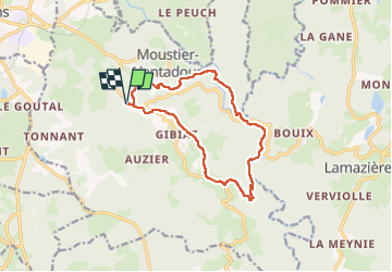
Trail Walking of 12.9 km to be discovered at New Aquitaine, Corrèze, Moustier-Ventadour. This trail is proposed by chanac les mines.
Positioning
Country:
France
Region :
New Aquitaine
Department/Province :
Corrèze
Municipality :
Moustier-Ventadour
Location:
Unknown
Start:(Dec)
Start:(UTM)
428837 ; 5026225 (31T) N.
Comments