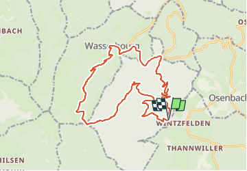
Wintzfelden - Wasserbourg

Alain28/01
User

Length
18.8 km

Max alt
909 m

Uphill gradient
790 m
Km-Effort
29 km

Min alt
412 m

Downhill gradient
784 m
Boucle
Yes
Creation date :
2025-03-15 21:06:03.175
Updated on :
2025-03-15 21:07:36.68
6h40
Difficulty : Difficult

FREE GPS app for hiking
 SityTrail
IGN / Geographical institutes
SityTrail Plus
The world is yours!
About
Trail Walking of 18.8 km to be discovered at Grand Est, Haut-Rhin, Soultzmatt. This trail is proposed by Alain28/01.
Positioning
Country:
France
Region :
Grand Est
Department/Province :
Haut-Rhin
Municipality :
Soultzmatt
Location:
Unknown
Start:(Dec)
Start:(UTM)
364837 ; 5315446 (32T) N.
Comments