


Lons Lanot RS2025

LouisROGER
User GUIDE
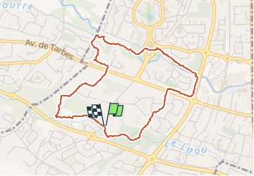

Length
4.8 km

Max alt
206 m

Uphill gradient
35 m
Km-Effort
5.3 km

Min alt
191 m

Downhill gradient
36 m
Boucle
Yes
Creation date :
2025-03-18 13:22:09.278
Updated on :
2025-03-18 15:16:43.085
1h54
Difficulty : Easy

FREE GPS app for hiking
 SityTrail
IGN / Geographical institutes
SityTrail Plus
The world is yours!
About
Trail Walking of 4.8 km to be discovered at New Aquitaine, Pyrénées-Atlantiques, Lons. This trail is proposed by LouisROGER.
Photos


Positioning
Country:
France
Region :
New Aquitaine
Department/Province :
Pyrénées-Atlantiques
Municipality :
Lons
Location:
Unknown
Start:(Dec)
Start:(UTM)
711014 ; 4800057 (30T) N.
Comments